We explore the physical geography of Europe, and explain how its major landforms were shaped. In addition, we describe the continent’s geologic features.
What is the physical geography of Europe like?
The physical geography of Europe is characterized by a rugged topography and structural formations that were shaped over various geologic periods. Its average elevation is 1,115 feet (340 m) above sea level, making it the lowest of all continents.
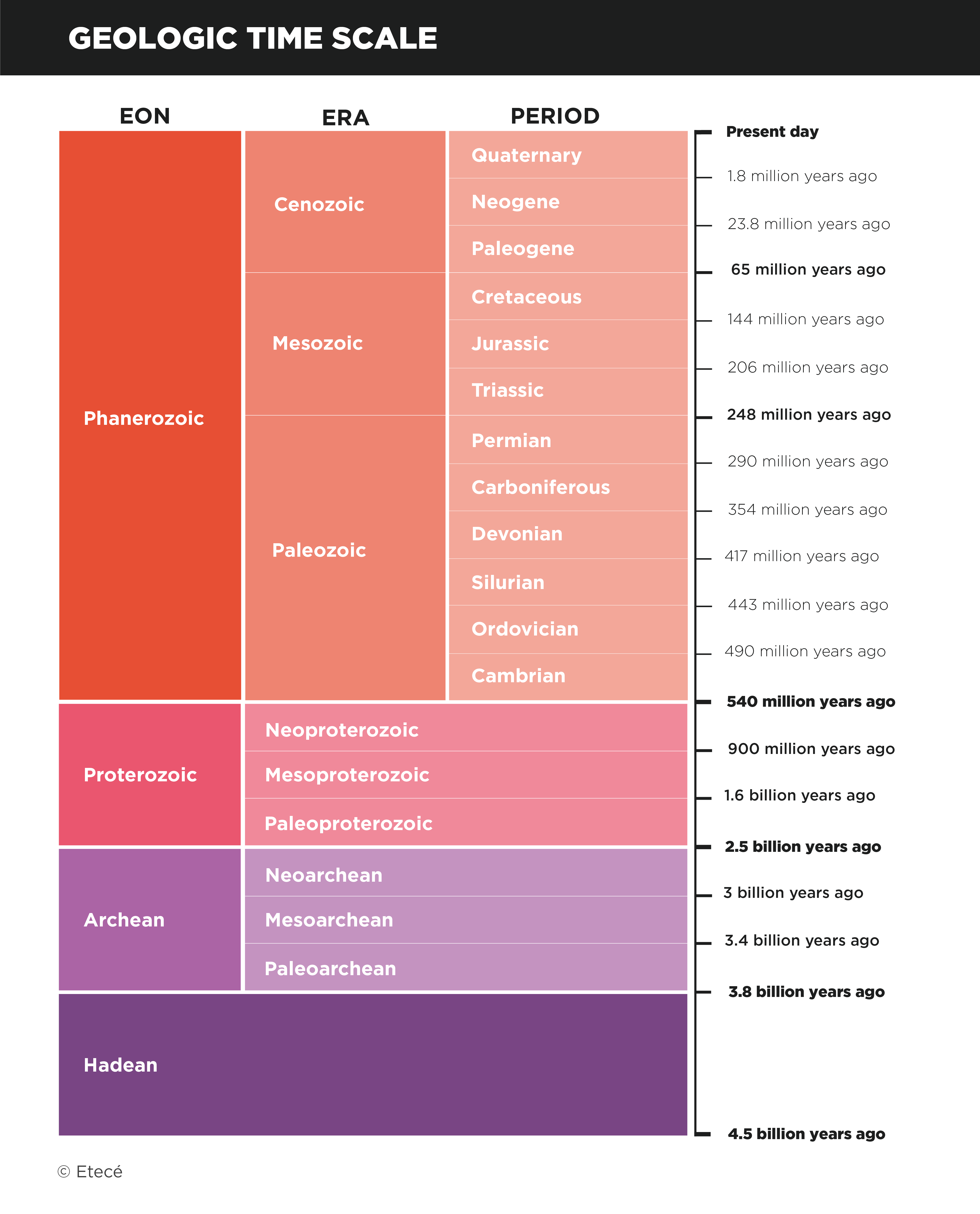
Some of its landforms are very old, dating from over 500 million years ago, such as the Baltic Shield and the Scandinavian Mountains. Others are younger in the geologic time scale, being formed only a few million years ago, like most volcanoes that make up the islands of Iceland. The continent’s highest points are young in time, and are marked by important seismic and volcanic activity. The most extensive plains are found in northern France, Germany, Poland, the Netherlands, and central Russia.
Frequently asked questions
What is the highest peak in Europe?
Mount Elbrus, situated in Russia, is the highest peak in Europe, at 18,510 feet (5,642 m).
What is the largest plain in Europe?
The Russian Plain, covering an area of 1,55 million sq mi (4 million km2).
What is the oldest geographic feature in Europe?
The Baltic Shield, consisting of rocks more than 2,500 million years old.
- See also: Physical geography of the Americas
Characteristics of the land relief of Europe
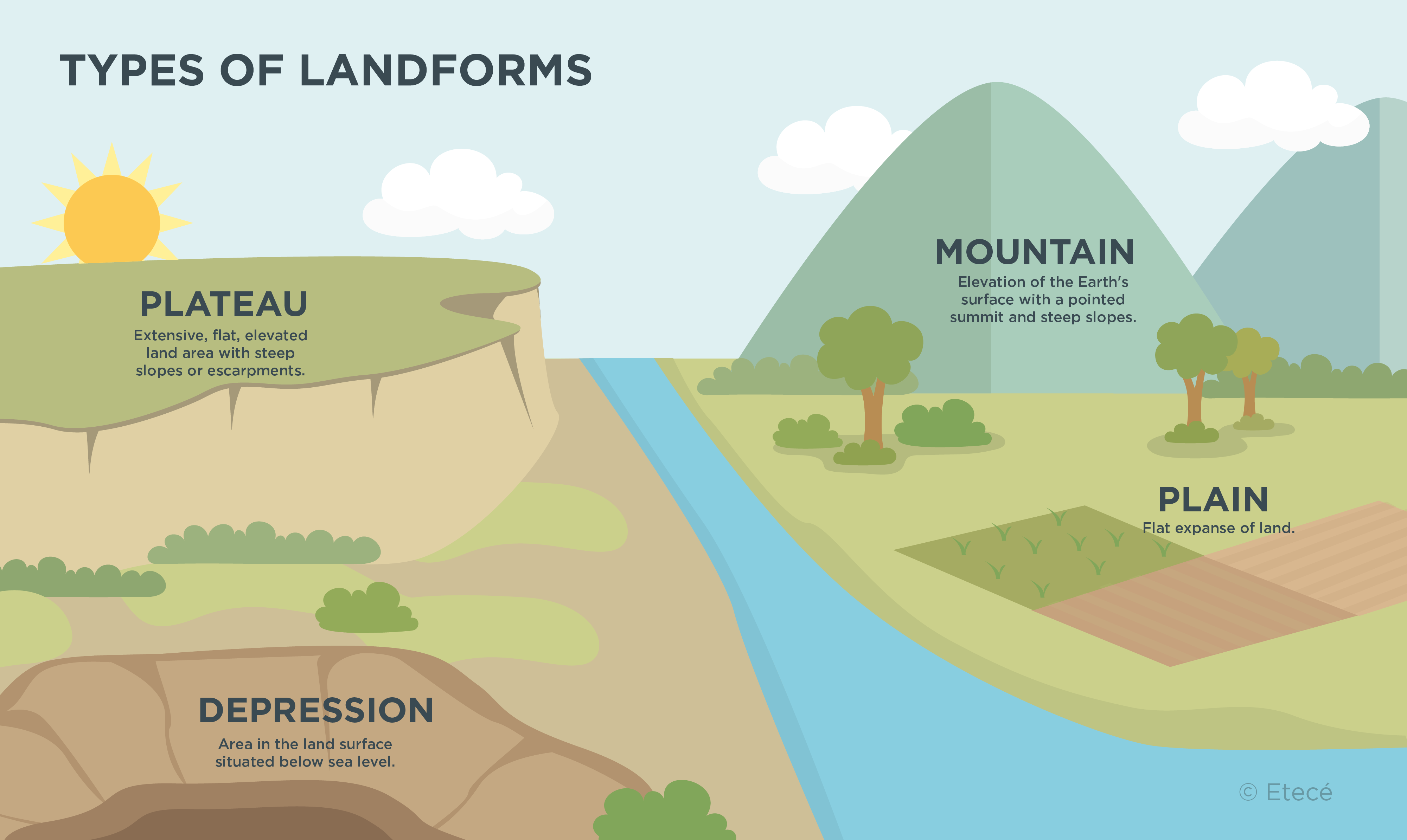
Europe’s land relief is made up of three major groups: plains, high plateaus, and mountain and volcanic ranges.
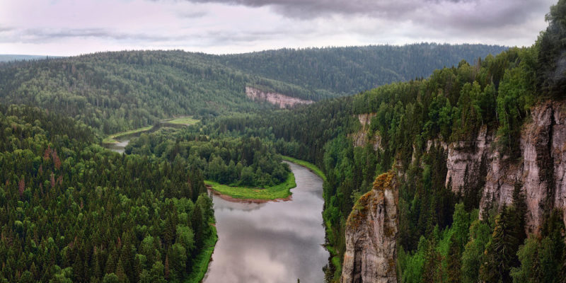
- Plains. Most of the European territory is covered by plains. They occupy an area of about 4,35 million sq mi (7 million km2), which accounts for nearly 70 % of the continent's total. Most of these plains are young in the geologic time scale, being formed during the Cenozoic Era. A large number of them are traversed by long rivers such as the Volga, Danube, and Ural rivers.
- High plateaus. They are very old massifs formed over the Precambrian and Paleozoic eras. These landforms are heavily worn by erosion, are lower in height and often have less steep slopes than mountain ranges. The Scandinavian, Central, and Iberian massifs are the most important on the continent.
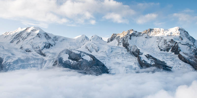
- Mountain and volcanic ranges. These landforms are young in the geologic time scale, shaped during the Cenozoic Era. They present the highest elevations on the continent, featuring steep mountains and volcanoes, and are characterized by important seismic activity. They are located near the Mediterranean Sea, on the tectonic boundary between the Eurasian and African plates.
Mountains, plateaus, and plains of Europe
Europe boasts over 26,720 miles (43,000 km) of coastline. In some areas, cliffs rise above sea level, while in others such as in Norway, there are fjords shaped by the interaction between the mountains and the advancing sea.
Along the coasts of Europe, peninsulas such as the Jutland, Italian, and Scandinavian are to be found. Gulfs are also a major geographic feature on the European coastline. Examples include the Gulf of Finland, the Gulf of Lion, the Gulf of Genoa, the Gulf of Venice, and the Bay of Biscay.
Straits are also major landforms on the coasts of Europe. The most important are the Strait of Gibraltar, the English Channel, and the Bosphorus, which are key maritime routes for global trade.
The major landforms of Europe are:
|
Plains |
|
|
Plateaus |
|
|
Mountains |
|
How was the land relief of Europe shaped?
Most of the European continent emerged during the Variscan orogeny about 300 million years ago. It consists of old, highly eroded, low-altitude landforms, such as the Iberian Massif, the Armorican Massif, the Massif Central in France, the Scandes, the Bohemian Massif, and the Ural Mountains.
The Alpine orogeny, in turn, was a younger mountain formation process that occurred in the Cenozoic Era as a result of the collision of the Eurasian and African plates. The resulting landscapes were less exposed to erosion, presenting higher altitudes and steeper slopes.
The Alpine orogeny led to the formation of the Cantabrian Mountains, the Pyrenees, the Alps, the Carpathians, and the Crimean Peninsula in the north; and the Baetic System, the Apennines, the Dinaric Alps, the Balkans, Crete and Cyprus in the south.
The Cenozoic Era also saw the emergence of the great plains on the continent. Both the Russian Plain and the northern plains began to form about 2.6 million years ago.
Explore next:
References
- Cátedra Uno (s.f). Relieve de Europa. CatedraUno
- Valverde, S. y otros (2010). Una geografía del mundo para pensar. Editorial Kapelusz.
- Tarbuck, E. y Lutgens, F (1999). Ciencias de la Tierra. Una introducción a la geología física. Prentice Hall.
- Yordán, E. (2022). Relieve de Europa. EcologiaVerde
Was this information useful to you?
Yes NoThank you for visiting us :)