We explore the Nile River, and describe its physical geography, flora and fauna. In addition, we discuss its general characteristics and history.
What is the Nile River?
The Nile River is the longest watercourse in Africa at about 4,130 miles (6,650 km), and the world’s second-largest after the Amazon River.
It flows through the territory of eleven countries before emptying into the Mediterranean Sea at the so-called Nile Delta. The Nile Delta is home to the cities of Cairo, the capital of Egypt, and Alexandria, the country's second most populous city. It is estimated that approximately 40 million people live in the Nile Delta.
The Nile River Basin is one of the largest in the world, with a total area of about 1,313,000 square miles (3,400,000 km2). It extends through 11 countries: Burundi, the Democratic Republic of Congo, Egypt, Ethiopia, Kenya, Rwanda, South Sudan, Sudan, Tanzania, Uganda, and Eritrea. The main tributaries of the Nile are the White Nile, which rises in Uganda, and the Blue Nile, which rises in Ethiopia.
The Nile Basin covers about 10% of Africa's surface area, and is home to an estimated 160 million people who depend on its water resources for sustenance, food, and economic activities.
The population relying on the waters of the Nile River is highly diverse, encompassing various ethnic groups and communities living in rural and urban areas along the river. These populations depend on the Nile for activities including agriculture, fishing, hydroelectric power production, tourism, and river transport.
The name “Nile” comes from the Arabic ni-l which in turn is derived from the Greek Neilos or from the Semitic root Nahal, meaning "valley" or “river valley”.
- See also: Dead Sea
Geological origin of the Nile River
The Nile River would have originated about 30 million years ago, during the Oligocene Epoch, when the African Plate began to move northward colliding with the Eurasian Plate. This collision created an uplift in the terrain forming a mountain range known as the Mountains of the Moon or the Rwenzori Mountains, in present-day Uganda.
Over time, snowmelt water from the mountains began to flow, forming small streams that joined to form the Nile River. As the Nile flowed northward, it carved a deep valley through the desert and deposited sediments in the alluvial plain of the delta, leading to the formation of the fertile Nile Delta plain.
Throughout the last millennia, the Nile River has witnessed numerous climatic and geological changes, with alternating periods of drought and massive flooding.
History of the Nile River
The historical importance of the Nile is linked to the rise of Ancient Egypt, one of the oldest and most prominent civilizations ever to exist. For 3,000 years, the Egyptian Empire flourished in the Middle and Lower Nile region, until its conquest and annexation by the Roman Empire in 30 BC.
The Nile River played a vital role in the history of Ancient Egypt. The frequent flooding and richness of the river guaranteed highly fertile lands that did not require intensive agricultural labor. Thus, the Egyptians devoted themselves to other activities such as culture, military actions, and religion. In addition, river circulation enabled the transportation of resources obtained in the desert regions of the south to the Empire's major cities in the north.
Nile River Basin
The Nile River is formed by different river systems or sections:
- Blue Nile. It rises in Ethiopia, at Lake Tana. It gets its name from the dark bluish color of its waters. Its main tributaries are the Abbay, Atbara, and Dinder rivers.
- White Nile. It originates at Lake Victoria, in Kenya. Its name is derived from the whitish color of its waters, which is due to the large amount of sediments and clay it carries. It meets the Blue Nile in the city of Khartoum, capital of Sudan. Its main tributaries are the Sobat, Baro, and Bahr el Ghazal rivers.
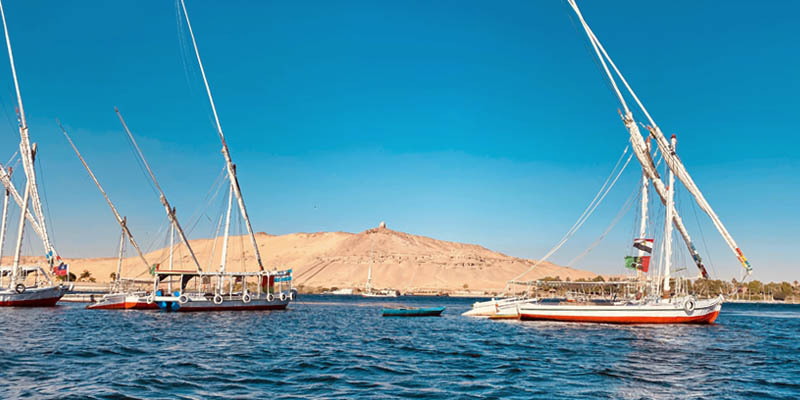
- Middle Nile. It covers the basin area stretching from Khartoum, where the White Nile and Blue Nile converge, to the city of Aswan in Egypt. This section of the river flows through a desert region with very low rainfall, which causes its volume to decrease considerably. This section exhibits important waterfalls and cataracts that make navigation and transportation difficult.
- Lower Nile. It stretches from Aswan to its mouth on the Mediterranean Sea. It is the Nile’s most fertile region, as the river deposits nutrient-rich sediments forming a wide valley that allows for intensive farming.
Nile Delta
The Nile Delta is the mouth of the Nile River which flows into the Mediterranean Sea. It is located in northern Egypt, and covers an area of approximately 9,266 square miles (24,000 km²).
The Nile Delta is formed by the branches of the river, which divide into various channels, in turn forming numerous islands. The delta is divided into two: the western and the eastern sides. The western, on the river's left bank, extends from Cairo to the city of Rosetta. The eastern, on the right bank, stretches from Cairo to the city of Port Said.
The Nile Delta is an extremely fertile region due to the annual flooding of the river, which deposits nutrient-rich sediments onto the land. This supports a wide variety of crops such as cotton, rice, sugarcane, vegetables, and fruits.
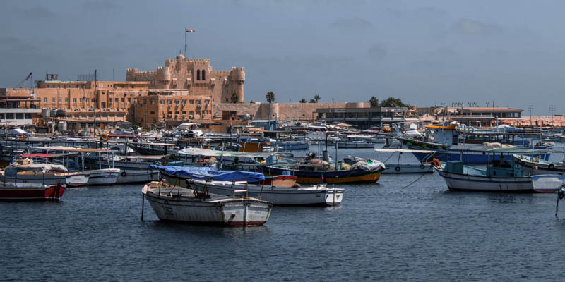
The Nile Delta is also home to major cities such as Cairo, the capital of Egypt, and Alexandria, the country's second-largest, as well as important ports for maritime trade like Port Said, Damietta, Rosetta, Abu Qir, and Dekheila.
Flora and fauna of the Nile River

The Nile basin is home to numerous indigenous species that only exist in this river. In the Lake Victoria region, where one of the headwaters of the Nile springs, the climate is humid and hot, leading to the development of forests and tropical jungles with an extraordinary variety of plant and animal species.
As the river flows northward, the climate becomes more arid, only exhibiting flora adapted to drought conditions. The greatest biodiversity is to be found in the delta region, at its mouth. Plants that the Ancient Egyptian civilization used for making the earliest paper or papyrus (Cyperus papyrus) grow in this area. In addition, the region boasts various types of bamboo, banana trees, and other species such as ebony.
In terms of fauna, there are about 129 fish species in the Nile, of which at least 26 cannot be found in other bodies of water. The Nile Basin is also home to the famous Nile crocodile (Crocodylus niloticus) and the Nile monitor lizard (Varanus niloticus), and is the spawning ground for the loggerhead sea turtle (Caretta caretta).
Economy of the Nile
Agriculture continues to be the most important economic activity in the Nile Basin, as it has been for over 5,000 years. This is especially the case in Egypt and Sudan, where the fertile lands of the delta support crops such as cotton, wheat, rice, and sugarcane.
Fishing is a major activity, particularly in Uganda, Kenya, and Sudan. Cattle, sheep, and goat farming are also important to the region's economy, especially for Sudan.
Likewise, tourism is an economic activity of great significance for the region. Millions of tourists visit the Nile Delta every year to see the Egyptian Pyramids. Adventure tourism and white water rafting on the Nile are also popular activities.
Pollution of the Nile River
Pollution of the Nile River is mainly caused by human activity in the Nile Basin, including intensive farming, livestock farming, industrial activity, and mining. The discharge of untreated wastewater, solid waste disposal, and the use of pesticides and other toxic chemicals pollute the water and affect the health of both human and animal life that depend on the river for sustenance.
Moreover, the fact that nearly all major cities in the region are located on its banks makes the Nile River the repository of the urban and sewage waste of millions of people.
Pollution of the Nile River also has economic consequences. Fishing and agriculture, two of the main activities in the region, have been negatively affected by water pollution, impacting the quality and quantity of fish and crops. Likewise, tourism, another crucial source of income, has been impacted in recent years by the rising pollution of the river.
Aswan High Dam
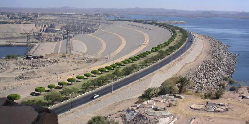
The Aswan High Dam is a hydraulic structure located in the Nile River in the city of Aswan, Egypt. It was built in 1970 to regulate the flow of the Nile, protect Egypt from floods, and improve irrigation in the region. In addition, the dam produces most of the country’s electrical energy.
The dam is 364 ft (111 m) high and 12,600 ft (3,830 m) long. Its artificial lake, Lake Nasser, is one of the largest in the world, with an area of nearly 2,030 sq mi (5,250 km²) and a storage capacity of 40.50 cubic miles (169 km3) of water.
Explore next:
References
- Egipto.net (s.f). La represa de Asuan. Egipto
- Flamarique, L. (2019). El Nilo ya existía hace 30 millones de años. LaVanguardia
- Flores, J (2023). El Nilo, río sagrado de Egipto. National Geographic. NationalGeographic
- Portillo, G (s.f). Río Nilo. MeteorologiaEnRed
Was this information useful to you?
Yes NoThank you for visiting us :)